
We often get questions about drones flying near or over land. While CAA-licensed drone pilots operate within strict regulations, coordinating with landowners/sites is becoming increasingly time-consuming. Here’s a simple explanation of the rules so you know what’s allowed, what isn’t, and why we sometimes provide extra information out of courtesy.
“Most of the time it’s easier to get official approval from Air Traffic Control & Military Sites to fly in a restricted zone than it is to satisfy all the extra requirements some landowners/sites make up.”
In the UK, the Civil Aviation Authority (CAA) regulates the skies. This means:
Drone pilots are responsible for:
Some checks are required only when flying near airports or Flight Restriction Zones (FRZs). In these cases, pilots must notify the National Air Traffic Services (NATS) and/or local Air Traffic Control (ATC).
Out of courtesy, many companies including us do inform landowners before flying. This is voluntary, not a legal requirement.
If you have any concerns about flights taking off from your property, take-off points can be arranged off-site to ensure operations happen safely and without using your land. This may help for your internal risk assessment requirements.
Landowners or property managers cannot restrict drones in the air above their land. The only way to request a temporary or permanent restriction is through a CAA NOTAM.
For more information, and to apply, see the CAA’s guidance here: CAA Airspace Restriction Request
Drone flights depend on several safety factors that can change quickly, especially weather conditions such as wind, rain, and visibility. As professional pilots, we can only fly when it is safe and fully compliant with CAA regulations and any active NOTAMs.
Because of this, we normally provide a time window rather than a fixed time. This ensures the flight is completed safely, legally, and with the best possible results for your project.
No. As long as the drone is operated legally by a CAA-licensed pilot following regulations and NOTAMs, landowners cannot restrict the flight.
No. You don’t need permission from the landowner to have a drone flown above their land, as long as the drone is operated legally by a CAA-licensed pilot following all regulations and NOTAMs. The pilot is responsible for planning and risk assessment, so you can rely on them to handle all legal and safety requirements.
Out of courtesy, you may choose to notify the landowner. If you want, you can even link them to this page https://cre8ivemedia.uk/drone-guidance-caa-uk-rules/ so they understand the rules and what’s actually required.
Yes. Even though a CAA-licensed pilot can legally operate a drone above the property without permission, it’s courteous to inform your tenants so they’re aware of the planned flight. This helps avoid confusion or concern, and keeps communication transparent.
You can also link them to this page so they understand the rules and what is actually required.
Take-off points can be on your property if agreed with the pilot, but they can also be off-site. Typically off-site is preferred as this is often best for safe VLOS of the drone. Flexibility ensures safety.
Yes, night-time drone operations are possible, but they require special planning and additional safety precautions. All our drones are Night Flight approved equipment.
We carry out full risk assessments, check airspace NOTAMs, and ensure any obstacles or hazards are clearly managed. As with daytime flights, we handle all planning, safety checks, and compliance — you don’t need to provide extra permissions.
In most cases, we can provide a general outline of the planned flight. However, exact flight paths are usually finalised on-site, as they depend on real-time conditions such as safety considerations, obstacles, people, and weather.
Whilst not always required by the CAA, we submit details for every flight where applicable and always check NOTAMs to ensure the airspace is clear and compliant.
As the licensed pilot, we are responsible for adapting the flight in the moment to ensure it is safe, legal, and compliant with CAA regulations. Our priority is always to capture the required footage while maintaining safe operations.
Example Flight Plan
UAV OP: CRE8IVE MEDIA | A2 CofC L/P | DJI Mavic 3 Pro 850g | VLOS/FPV OPS | FL ≤ 400ft AGL | LAT/LONG 51.4000N 1.3200W | DATE 01JAN26 | TIME 1000-1100Z HAZ: Obs, Pers, WX, SYS FAIL | MIT: LiDAR/VF scan, Geo-fence, EXCL 5m, Spotters, METAR/TAF chk, BRS/RTH, FPV w/spotter | RSK: L | ABRT: Wind>15kts, VIS<2km, Pers encroach, Sys fail FLIGHT PATH: TO/LD off-site preferred, waypoint via GPS, alt ≤ 400ft, VLOS maintained 100% | FPV limited, spotter present | AIRSPACE: FRZ CLR via ATC/NATS, NOTAM checked and filed | COMM: RC 2.4GHz, redundant link, auto-RTH engaged | DATA: CAM SEC, REDUND, PRE-FLIGHT INSP OP NOTES: WX & OBST continuous monitor, MISSION ABRT triggers as above, flight plan flexible for safety, mission executed under CAA 2019/947 compliance.
Which Means
CRE8IVE MEDIA – UAS/Drone Flight Plan Date: 01/01/2026 Location: Newbury Industrial Park, Berkshire Coordinates: 51.4000N 1.3200W Altitude: Max 400 ft AGL Aircraft: DJI Mavic 3 Pro (850g) Pilot: A2 CofC Licensed Operation Type: VLOS, FPV optional Flight Duration: 10:00 – 11:00 local time Purpose: Aerial videography for commercial media production NOTES: - Flight within visual line-of-sight at all times. - FPV operations only with spotter assistance. - Obstacle and airspace checks completed. - Emergency procedures: Automatic Return-to-Home (RTH) enabled. - Weather limits: Abort if wind > 15 kts, visibility < 2 km, or precipitation. - Airspace: Flight cleared under FRZ guidance; NOTAM reviewed and approved by NATS/ATC. - Take-off and landing: Prefer off-site or designated exclusion zones to minimise risk.
Or simply on the day of the flight check the NOTAMs on a NOTAM map Here our flights should be blue above your location, this is normally only submitted before the flight due to changing conditions
A NOTAM (Notice to Air Missions) is a notice issued by the CAA to notify pilots of temporary restrictions or hazards in the airspace. Pilots check NOTAMs before and during flying to avoid restricted areas.
Yes. Professional drone pilots carry insurance covering liability, accidents, and damage. Pilots are responsible for risk assessments and safety precautions.
Pilots must comply with privacy laws, avoid filming people without consent where possible, and only capture footage necessary for their project.
Under UK law, all drones must stay below 400 ft (120 m) above ground level unless special permissions are obtained from the CAA. This limit ensures safety for other aircraft, people, and property.
We always plan flights to capture the footage you need within legal limits. Flying higher than 400 ft without approval would be illegal and unsafe, so we do not do this.
If you would like to request a flight above 400 ft, please let us know and we can arrange this with the CAA through the proper approval process.
Under UK law, drone flights must normally stay within the pilot’s visual line of sight (VLOS). Flying BVLOS is heavily restricted and requires special approval from the CAA.
Our standard operations are designed to capture all necessary footage safely within VLOS. In some cases, we can extend coverage slightly beyond VLOS of the pilot by using trained spotters to maintain safety and visual awareness of the drone.
If you think your project requires BVLOS, let us know and we can discuss options and the necessary CAA approvals. These flights are carefully planned and risk assessed to ensure compliance and safety.
Special rules apply near airports and FRZs. Pilots must notify Air Traffic Control and may be restricted from flying in certain areas to ensure safety.
All airspace restrictions and guidance are issued by the CAA. See: CAA Airspace Restrictions
Yes! Our A2 CofC licensed and insured pilots are trained to work with NATS and local Air Traffic Control (ATC) to obtain the necessary flight clearance. This allows us to safely and legally carry out drone work within FRZs for your project.
No. Our pilots carry out their own on-site + off-site risk assessments as part of their professional procedures. You don’t need to provide any paperwork or checks — we handle all safety planning and compliance ourselves to ensure a safe operation.
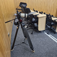
We carry out our own site-specific risk assessments (RAMS) as part of every operation. These are working documents used by the pilot to ensure the flight is conducted safely and in compliance with CAA regulations.
Only Air Traffic Control (ATC) may request these documents, and they are usually written in technical ATC terminology. For most clients and landowners, sharing the full risk assessment is unnecessary. However, we are happy to provide a plain-language summary or discuss any safety considerations to give you full confidence in the operation.
Example risk assessment
UAV OP: CRE8IVE MEDIA | A2 CofC L/P | DJI Mavic 3 Pro 850g | Lat/Long [XXXX] | VLOS/FPV OPS | FL ≤ 400 ft AGL | NOTAM/NATS CLR REQD HAZ: Obs, Pers, WX, SYS FAIL, AIRSPACE | MIT: LiDAR/VF scan, Geo-fence, EXCL 5m, Spotters, METAR/TAF chk, BRS/RTH, FPV w/spotter, ATC CLR | RSK: L | ABRT CRIT: Wind >15kts, VIS <2km, PERS ENCROACH, SYS FAIL | COMM: RC 2.4GHz, redundant link, auto-RTH, fail-safe geo-lock | DATA: CAM SEC, REDUND, PRE-FLIGHT INSP | OP: VLOS maintained, FPV under spotter, FRZ CLR via ATC/NATS, WX + OBST continuous monitor, MISSION ABRT triggers as above.
Which means
UAV RA v1.0 | CRE8IVE MEDIA Date: 01/01/2026 Location: [GRID REF / Lat/Long] Aircraft: DJI Mavic 3 Pro / 850g Pilot: A2 CofC Licensed Operations: RPAS, VLOS, FPV optional HAZARD ID | RISK | MITIGATION | RESIDUAL ------------------------------------------------------- Obstacle Collision | Mid-air static structures, wires | Pre-flight LiDAR / Visual scan, GPS geofencing, ATC NOTAM review | Low Personnel Conflict | Public access near TO/LD | Demarcated exclusion zone 5m radius, spotters deployed | Low Airspace Conflict | Controlled / restricted zone | FRZ clearance via NATS / ATC, flight plan submission, NOTAM check | Negligible Weather | Wind >15 kts, rain, low vis | WX brief + live METAR, abort if criteria exceeded | Low System Failure | UAV RTB failure / comm loss | BRS enabled, preflight battery + comm check, auto-RTH, fail-safe geo-lock | Low Data Capture | Camera equipment / payload drop | Secure mount, preflight inspection, redundancy check | Low Operational Notes: - VLOS maintained 100% of mission. - Flight altitude ≤ 400 ft AGL, compliant with CAA reg 2019/947. - FPV operational only within visual line-of-sight, spotter present. - ATC notified of mission via [INSERT CHANNEL], NOTAM confirmed. - Weather and obstacle monitoring continuous. - Mission abort triggers: wind > 15 kts, visibility < 2 km, personnel encroachment. End of RA.
Which means
Drone Risk Assessment – CRE8IVE MEDIA Date: 01/01/2026 Location: [Insert location] Drone: DJI Mavic 3 Pro (850g) Pilot: A2 CofC Licensed Operations: Standard line-of-sight (VLOS), optional FPV Key Hazards and How We Manage Them: - Collisions with obstacles: Wires, buildings, and other structures are identified before flight using visual checks and GPS geofencing. Flight plans are checked against NOTAMs. - People nearby: A safety zone is marked around take-off and landing areas, and spotters are deployed to keep the public clear. - Restricted airspace: We get official clearance from ATC/NATS and check NOTAMs to ensure we are allowed to fly. - Weather: Flights are only carried out in safe conditions. Wind, rain, or poor visibility above our limits will result in postponing the flight. - Equipment or system failure: Drones are checked before flight, batteries and connections are tested, and fail-safes like automatic return-to-home are enabled. - Camera/data safety: Cameras are securely mounted and inspected before flight, with backups in place where possible. Operational Notes: - The drone is kept within visual line-of-sight at all times. - Flights stay under 400 ft above ground and follow all CAA regulations. - If FPV is used, a spotter is present to assist the pilot. - Weather and obstacles are monitored continuously during flight. - Flights will be aborted if conditions are unsafe: high wind, low visibility, or if people enter the flight area. - All flights are planned and risk-assessed in advance, and official clearance is obtained if required.
Absolutely! We’re more than happy for you to watch the drone in action. Seeing the operation up close can be exciting and helps you feel involved in the process.
For safety reasons, please observe from a safe distance and avoid talking to the pilot during the flight, as they need to maintain full focus. If you’d like, we can even supply a live feed on a big monitor so you can watch the footage in real-time without impacting the operation.
Our priority is always safe and legal flight operations, but we love letting clients see the action when it’s safe to do so.
No. Commercial drone work in the UK must be carried out by a CAA-licensed pilot operating under an appropriate qualification, such as the A2 CofC. This ensures the pilot is trained, insured, and compliant with all safety and legal requirements. Flying commercially without a license is illegal and unsafe.
Even small drones with cameras are still subject to CAA regulations if flown commercially. While some very lightweight drones are less restricted for hobby use, any drone used for professional work or filming must be operated by a CAA-licensed pilot, with proper insurance, safety checks, and compliance with NOTAMs. So even a tiny drone on your site must follow the same professional rules as larger drones.
No. Even very small drones with cameras are subject to CAA regulations in FRZs. Any commercial drone flight in a restricted area requires a CAA-licensed pilot and prior clearance from NATS or local Air Traffic Control (ATC). Size does not exempt the pilot from following safety, insurance, or NOTAM compliance requirements.
Drone insurance isn’t like car or home insurance — it normally doesn’t contain an expiry date, it’s tied to the licensed pilot and their qualifications, not necessarily a name, company or company name on the paperwork. This can mean that even if the policy lists a different name, the pilot is fully covered for commercial operations on any legal flight or drone for £1m commercial cover.
Because of this setup, sharing full insurance documents can sometimes cause confusion. All flights we carry out are legally and fully insured under professional drone regulations.
We focus on providing information that is actually relevant — essentially, no more than we would need to give Air Traffic Control (ATC). Our goal is to keep operations safe, legal, and compliant with CAA rules.
If this means you feel you can’t work with us because other companies will produce whatever you ask for, that’s completely fine — it’s your choice. Often, companies that supply every document or extra detail are less in tune with CAA rules and may not prioritise safety as rigorously as we do.
Ultimately, our approach is about safe, compliant, and professional drone operations, not creating unnecessary paperwork.
Not at all! Every “no” reflects real legal, safety, and regulatory requirements. Each UAV mission involves an incredible amount of research, pre-planning, and paperwork to ensure safety, airworthiness, and compliance with CAA rules and NOTAMs.
Many of the additional requests we sometimes receive from landowners are not legally required — they go beyond what even ATC needs. In fact, we’ve occasionally come across landowners rejecting risk assessments that are fully approved by NATS and ATC. Our priority is to operate safely, legally, and efficiently, while respecting landowners as much as possible.
These rules aren’t about being awkward or lazy — they exist to protect you, the pilot, the public, and to ensure the highest quality results for your project.
For all new clients, we provide a full compliance and identification pack prior to filming. This includes:
• Pilot ID
• DBS Check (where required)
• CAA Operational Authorisation / Flyer ID
• Public Liability Insurance
• Drone-specific Insurance
On-site, we operate in a clearly identifiable and professional manner. Our pilot will wear appropriate PPE, including a high-visibility top marked "Drone Pilot", along with visible accreditation where required.
We also establish a safe and controlled take-off and landing zone, ensuring a sterile operating area to minimise risk to people, property, and equipment.
We have previously held CSCS accreditation; however, under current UK guidance, videography and photography are not classified as recognised construction trades and therefore are not eligible for CSCS cards.
Following direct discussions with the relevant governing bodies, the position is clear: drone operators and videographers are not required to hold a CSCS card, and in most cases, cannot obtain one.
In practice, we typically operate off-site or within controlled areas. Where site access is required, we attend fully compliant with site safety expectations and are happy to align with any specific requirements in advance.
Standard PPE includes:
• Hard Hat (EN397)
• High-visibility clothing (EN compliant – (orange) t-shirt EN471 and/or jacket EN ISO 20471)
• Workwear trousers
• Safety footwear
• Hearing protection (EN352 compliant – Bluetooth-enabled for audio monitoring when required, e.g. during interviews)
• Eye protection (EN166 compliant, used when appropriate)
• Gloves (EN388 compliant, used when not actively operating equipment)
If your site has specific PPE or induction requirements, please let us know ahead of time and we will ensure full compliance.